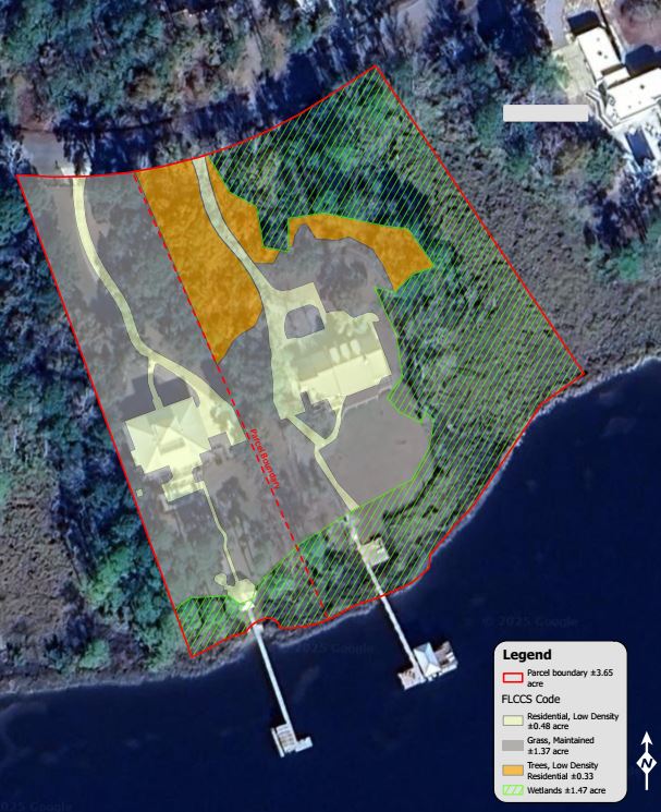
A habitat preservation analysis and wetland delineation along LaGrange Bayou in Freeport applied field-based GPS mapping and FLCCS classification to evaluate vegetation and land use, distinguishing maintained cultural landscapes from remnant natural habitats. The assessment confirmed that uplands consist primarily of landscaped and previously developed areas exempt from preservation requirements, providing a clear foundation for LDC compliance and redevelopment planning.


